Have Questions? We’re Here for You!
Senectus velit sagittis inceptos fringilla mus mauris convallis lobortis.

China Moneypro
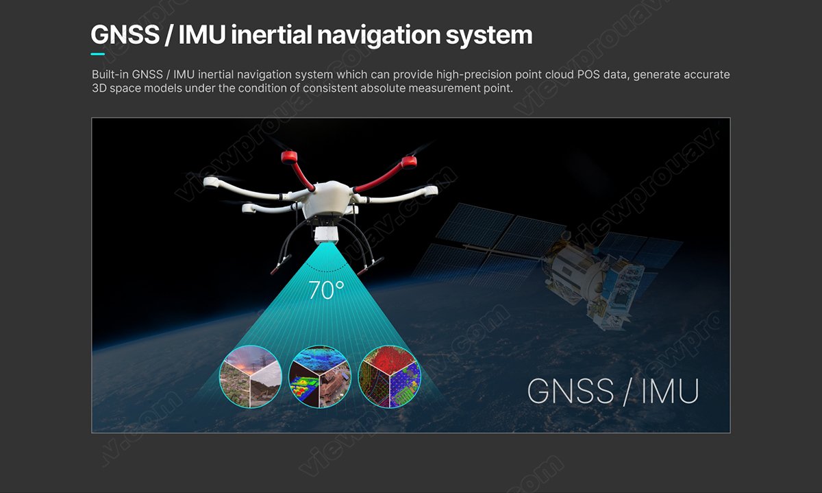
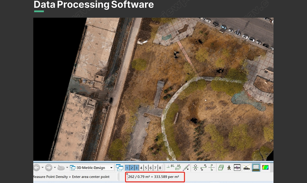
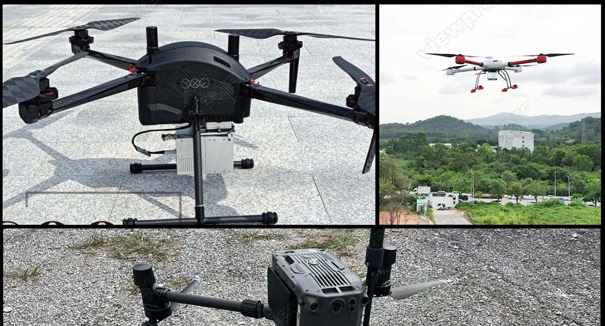
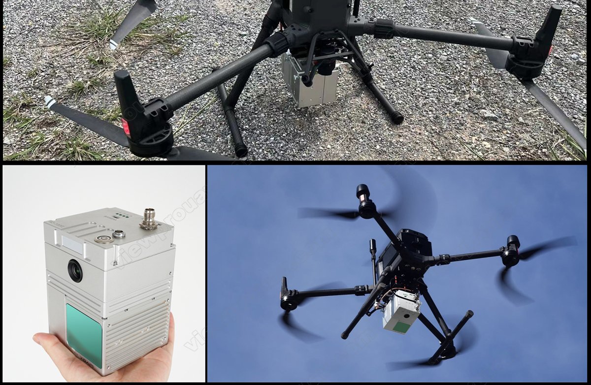
MGS-100C LiDAR scanning system integrates with Livox new generation laser scanner, GNSS satellite precise positionsystem, INS (inertial navigation system) and Sony A6000 24mp camera which is a compact LIDAR point cloud data acquisition system to enable real-time,dynamic and massive collection of high-precision point cloud data and image information.
| Model: GS-100C | Item | Parameter | ||
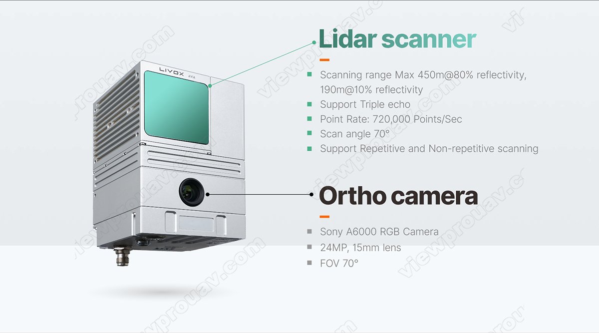
| Laser Scanner | Measuring Range | 190m@10% reflectivity | ||
| Laser Class | 905nm Class1 (IEC 60825-1:2014) | |||
| Laser Line Number | Equivalent to 64-beam | |||
| FOV | 70 the circular view | |||
| Range Accuracy (1 @ 20m) | 2 cm | |||
| Data | Triple echo,720,000 Points/Sec | |||
| Camera | FOV | 70 | ||
| Resolution | 24MP | |||
| Focus length (mm) | 15mm | |||
| POS | Update Frequency | 200HZ | ||
| Pitch /Roll Accuracy | 0.015 | |||
| Heading Accuracy | 0.040 | |||
| Position Accuracy | 0.05m | |||
| GNSS Signal Type | GPS L1/L2/L5,GLONASS L1/L2BDS B1/B2/B3,GAL E1/E5a/E5b | |||
| System Parameter | Accuracy | 10cm@110m | ||
| Weight | 1050g | |||
| Working Temperature | -20 ~ 55 | |||
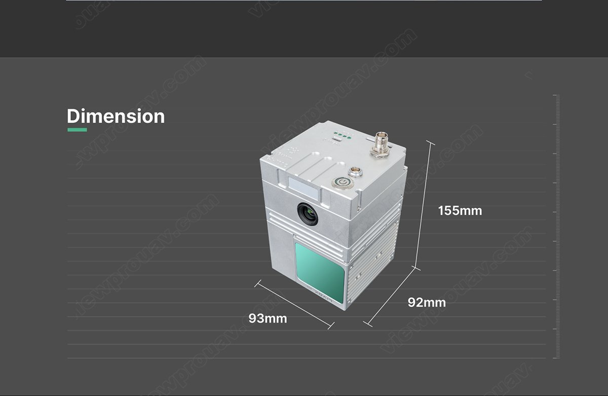
| Dimension | 15.5*9.2*9.3cm | |||
| Storage | Internal 64 GB, Max support 128GB TF card | |||
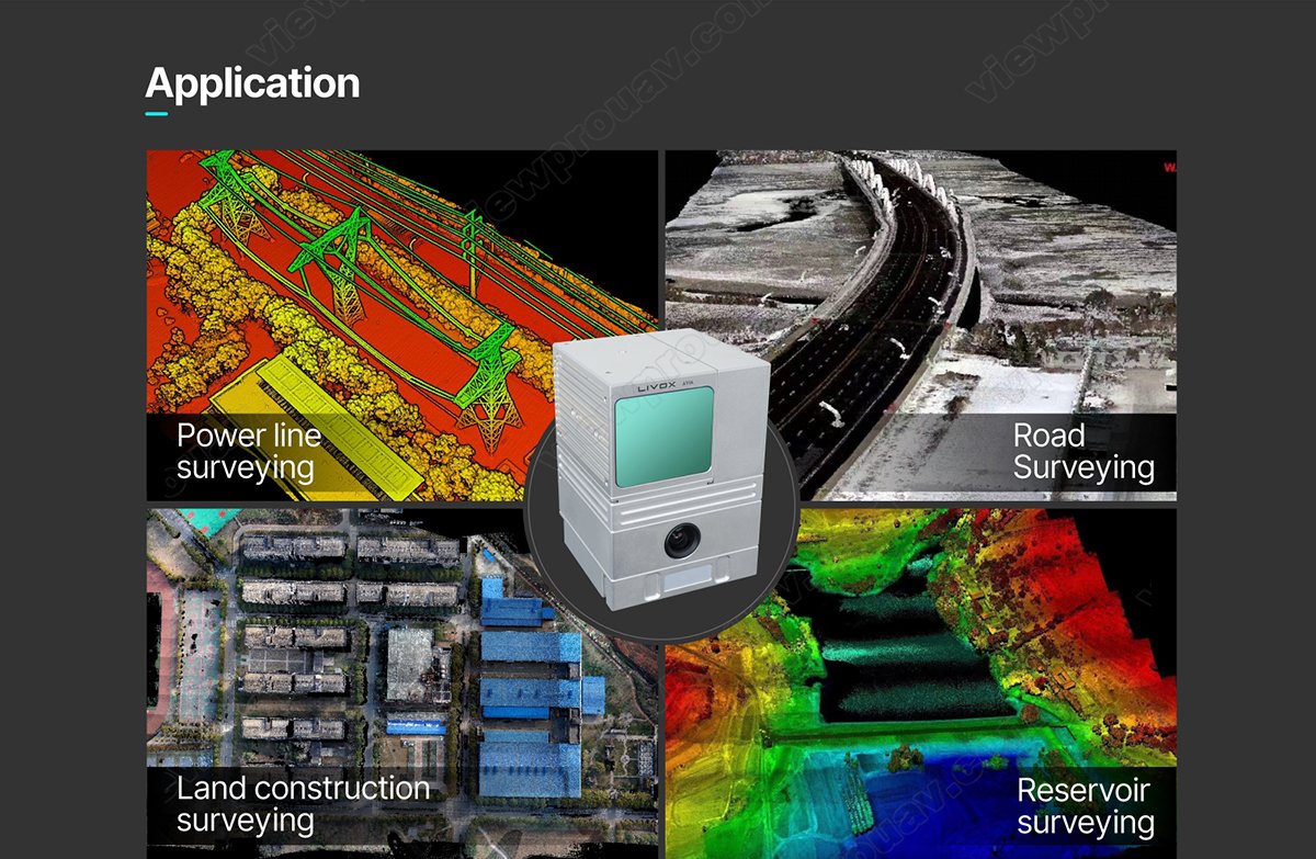
| Carrying Platform | Multicopter with 10m/s flight speed | |||
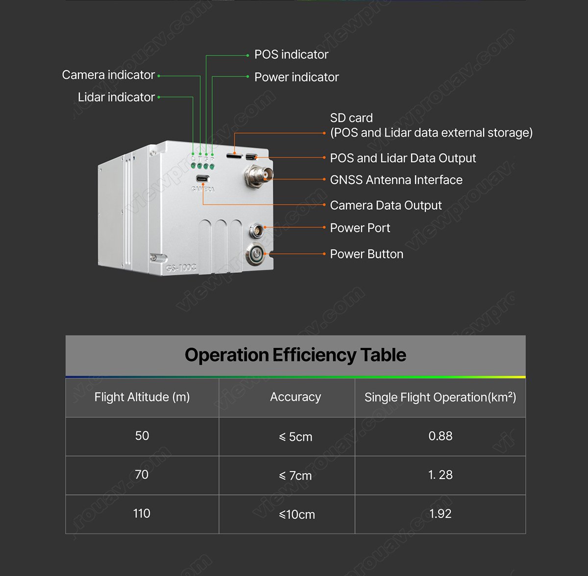
| Operation Efficiency Table | ||
| Flight Altitude (m) | Accuracy | Single Flight Operation(km2) |
| 50 | 5cm | 0.88 |
| 70 | 7cm | 1.28 |
| 110 | 10cm | 1.92 |


